الصناعة· INDUSTRIAL · DIGITAL TWIN
Mir'atمرآة
One live 3D model of every asset — GIS, IoT, and visual feeds fused into a single operational surface.
A real-time digital twin that combines geospatial data, IoT sensor feeds, and live camera views into one unified 3D model of the plant, so operators see exactly what is happening across every asset without switching between systems.
من يرى المصنع كله في مرآة واحدة، لا يُفاجَأ بما يحدث في زاوية منه
“Whoever sees the whole plant in one mirror is never surprised by what happens in its corner.”
What Mir'at does
Unified 3D operational model
Every physical asset — tank, pump, pipeline, substation — has a live digital twin positioned in one coherent site model.
GIS and IoT fused in one view
Geospatial layout and real-time sensor readings sit on the same model, so location and condition are never two separate lookups.
Live visual feed integration
Field camera feeds are attached directly to their asset in the twin, giving operators a visual check without leaving the console.
Sub-two-second sync latency
Sensor updates reflect in the model in under two seconds, so the twin represents current state, not a stale snapshot.
Full asset registry with history
Every asset carries 90+ days of operational history alongside its live state, for trend review without a separate historian query.
Extensible to predictive layers
The twin integrates directly with predictive maintenance and safety modules, so risk overlays appear on the same operational surface.
See Mir'at in action
An early UX walkthrough of the product, designed bilingually from day one.
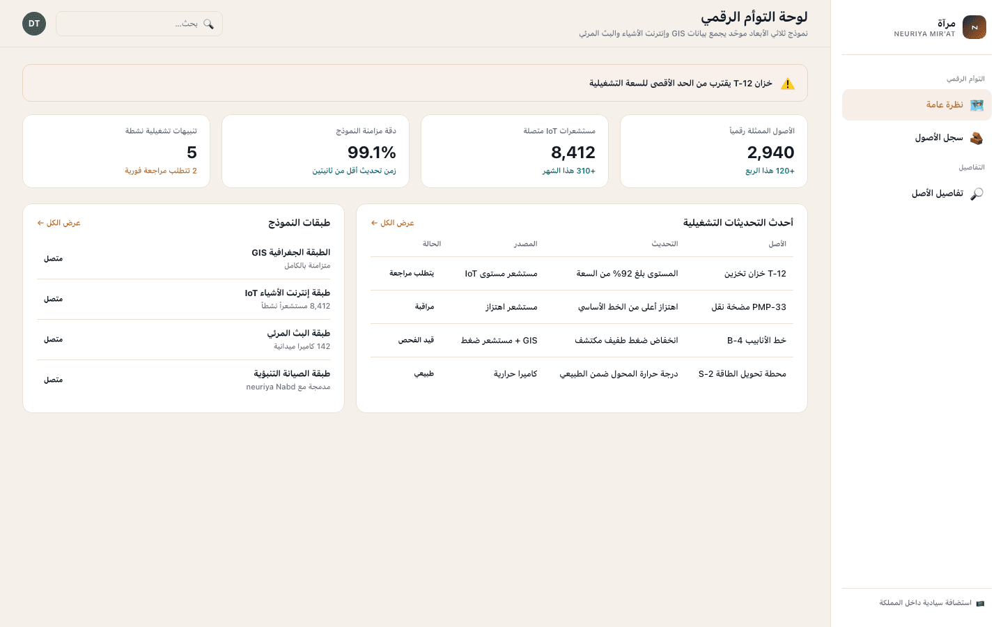
Digital twin overview
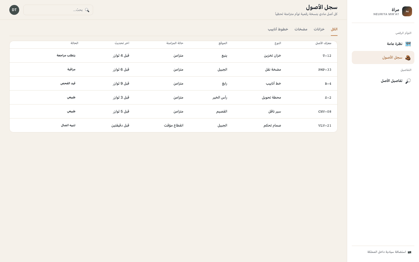
Asset registry
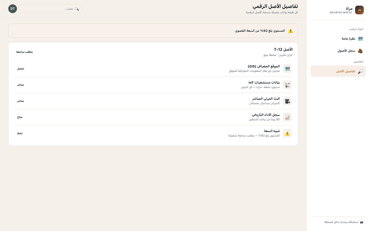
Asset twin detail
How it works
Model
Every physical asset is mapped into the 3D model, positioned against the site’s GIS layout.
Connect
IoT sensors and field cameras are wired into the model, streaming live state to each asset’s twin.
Monitor
Operators work from one unified view instead of switching between GIS, historian, and camera systems.
Act
Alerts surface directly on the model, so the operational response starts from the same picture everyone is looking at.
See your whole plant in one live model
We're selecting design-partner sites for the first digital twin deployment cohort. Book a briefing to review your GIS, IoT, and camera infrastructure.
Request a Pilot